Showing posts with label national park service. Show all posts

January 10, 2017

Timucuan Ecological and Historic Preserve & Fort Caroline National Memorial

Just to the east of Jacksonville, Florida and encompassing thousands of acres surrounding the mouth of the Saint Johns River is the Timucuan Ecological and Historic Preserve. The area is named after the Timucua people who inhabited the area in the 1500s when the Spanish and French settled. As I have shared in previous posts the Spanish claimed all of North America when they first arrived, but it was the French who attempted to establish a colony first. In 1562 explorer Jean Ribault arrived and erected a monument at the mouth of the Saint Johns River. He was soon followed by more French soldiers and settlers, who in 1564 established Fort Caroline on the south bank of the river. 

Displaying IMG_0076.JPG

The Spanish, upon learning of the infringement, sent Admiral Pedro Menendez de Aviles to remove the French. He did so in bloody fashion, attacking and slaughtering its soldiers in 1565. The Spanish renamed the fort San Mateo and began settling the area to preserve it as part of their territory. The Timucua slowly faded, leaving behind remnants of their culture. An example of this is the mounds of oyster shells can be found in the preserve, left from their meals during their reign. 
By the time of the American Revolution the area had passed to the hands of the British, who established a settlement at St. Johns Bluff. During the war, several skirmishes and battles were fought in Northeast Florida between the British and American troops from Georgia. During the second Spanish era (1873-1821) there was a rapid expansion of farming in the preserve, with plantations being established to take advantage of the rich soil on the coastal islands. The best known was a farm on Fort George owned by Zephaniah Kingsley (The story of this plantation and its inhabitants will be shared in a future story).
As time continued the area was kept mostly in its natural state, and in 1988 it was established as the Timucuan Ecological and Historical Preserve. In the 1960’s the first replica of Fort Caroline was built and later destroyed by a hurricane. It has since been rebuilt, at full scale, in a location believed to be near where the original stood. There is some question as to the exact location of the original French fort, and some scholars have proposed other locations.
Kristina and I drove from Orlando to the location of the preserve early in the morning. Upon arriving we quickly went into the visitor center to give us a better understanding of what was in store for us. We hadn’t done much research before this particular visit, other than the references from our previous journeys (see Fort Matanzas NM and Castillo de San Marcos NM) and really had only a little knowledge. We were thrilled to find a very knowledgeable and friendly park ranger, who gave us a brief timeline and oral history of the Preserve and Fort Caroline. There is a small room of displays in the visitor center and we took a look and the tangible history of the area. The old Timucua canoe was my favorite display, and I imagined what it must have been like to paddle up and down the Saint Johns River before the cities and towns were established. After stamping our passports and saying goodbye to the ranger we headed to the car to grab our hiking gear.

Displaying IMG_0083.JPG

There is a small hike to the fort that starts behind the visitor center that leads to the replica of Fort Caroline. It leads up the side of the river and includes a replica of an old Timucua building with a brief description. We continued up the trail andtook a small side trip to the end of a pier that has been built for people arriving on boat. From there it was only a little further to the fort. Fort Caroline is a triangle structure with a large grass area in the center. We took our time walking around and looking over the barricade to see the river, and checked that no Spanish soldiers were breaching our settlement. As we talked about the layout and snapped a few photos, we were even greeted by a low flying helicopter. We waved as they passed, most likely heading to the Naval Base down the river, and remarked that the area is still a prime location for military establishments. 
After our tour of the memorial, we decided to take one quick nature hike to break in our brand new boots. There is a short loop trail that leads from the fort and ends back near the Visitor Center. Kristina and I took our time on this hike, and were very happy to discover most of the trail was covered in shade. We came upon a few creatures on our hike, mostly birds and some crabs, and found a nice bridge that crossed a small creek. We discussed different hiking skills that Kristina has asked me to teach her, like how to identify Poison Ivy. We began talking about what we would be doing for lunch afterwards and soon found ourselves back near the parking lot. This marked the end of this journey, due to time restraints and the hot summer weather. 
There are many more trails in the preserve and an entire area north of the river that we did not make it to on this trip. We promised ourselves that we would return to visit again and learn more about the Kingsley Plantation, something that we have recently accomplished. That, however, is another journey and story for another time.

For More Information
• Please visit the Visitor Center at the Preserve in person, or online at www.nps.gov/timu.

December 3, 2016

Castillo de San Marcos National Monument

        Built by the Spanish between 1672 and 1695, the Castillo de San Marcos is one of the most historically significant structures in Saint Augustine. Designed to protect what is now “America’s oldest city”, the coquina fort was positioned strategically on Matanzas Bay. Since construction was completed the fort has changed hands five times, but never through force. Military agreements or political treaties had led to the area being controlled by the Spanish (1695-1763), the British (1763-1784), the Spanish again (1821-1861), the United States of America (1821-1861), the Confederate States of America (1861- March 1862), and finally the United States again (1862-1900).

The fort was built to withstand sieges and keep the people of the city safe until reinforcements arrived or the attack ended. This is something that has been done very successfully in the history of the city. However, this is not the only use that befell the fort and at times it was used to jail many Native American leaders during the American Territorial Period and during “manifest destiny” (1870s-1880s). Renamed Fort Marion it saw little action during the Civil War, and local authorities gave control of the city to the USS Wabash on March 11, 1862. The fort was used again as a prison, holding almost 200 court-martialed deserters for the American Army. At the end of the 19th century, the fort completed its long tour of duty (205 years) and was made a national monument in 1900. In 1933 she was given her original name back, and she still stands as the Castillo de San Marcos National Monument.

Kristina and I arrived in Saint Augustine in the afternoon and first we stopped for lunch in the historic section of the city (which is walking distance to the fort).  When visiting the city there is plenty to do, from shopping and food, to “ghost” and history tours. There is even a craft distillery and the entire historical center is decorated in white lights during the holiday season. We were visiting in the summer, however, and as a result it was very hot and humid.


Walking up to the monument you can see its significance to the city. Positioned on the city wall and harbor she stands ready for any attack. Before entering we stopped by the fee station and used our annual pass, which is still the best birthday gift. There is only one entrance, which is surrounded by walks and forces you to cross what was once a moat. Walking inside takes you back in time, with the tourist families and the information desk being the only things that seem out of place. We immediately went into the gift shop near the entrance and got our Passport to the National Parks stamped for this stop. Next, we began to walk around the bottom areas of the fort. Going room to room we were able to read displays about the history of the fort and what each area was used for. Some videos were playing in a loop, including one that showed a drill team demonstrating the firing of the old Spanish cannons. We continued to walk around the fort and enjoyed the view from the top of the structure. Imagining what it might have been like to see nothing but the white sails of an enemy ship approaching from the inlet.


While we had a good time visiting the Castillo de San Marcos National Monument, it was not somewhere we stayed for a very long time. Having seen the entire section, and the fact that this was July in Florida, we began our walk back to the car. We are planning on visiting the fort again, to watch one of the cannon drills in person.


*Plan Ahead
For any visit to Florida in the summer, it is very important to be aware of the weather. Temperatures can reach near 100 degrees with very high humidity most days between May and August. On top of this strong thunderstorms can build and move quickly during this time of year, making it even more humid after the rains stop. Water, sun protection, and being aware of the signals your body is giving you are a MUST. Be safe in your journeys at all times.

For More Information
Please visit the Castillo de San Marcos National Monument in Saint Augustine, Florida in person, or online at www.nps.gov/casa.

November 18, 2016

Fort Matanzas National Monument


Fort Matanzas National Monument is located on the eastern coast of Florida, approximately a 30-minute drive south from Saint Augustine. It is a small coquina fort built at the mouth of an inlet to the Florida intercoastal waterway. Fort Matanzas was proclaimed a national monument on October 15, 1924 and was put under the control of the National Park Service in 1933. Built by the Spanish, construction lasted from 1740 until 1742, as a way to protect the “back door” to the settlement of Saint Augustine from invasion. The area around the fort has a very interesting story, which is the result of the struggle between European nations to claim and control the New World.

The story of this particular area can begin in 1565, when a French Huguenot named Jean Ribault lead his troops (which outnumbered the Spanish in the area)south to attack up the river into Saint Augustine. However, nature was not kind to this expedition, and the fleet got caught in a hurricane that hit the northeastern coast of La Florida. This scattered the ships of the fleet and kept the men at sea for some time. Meanwhile the Spanish, led by Pedro Menendez, traveled by foot north from Saint Augustine to capture the French settlement named Fort Caroline on the St. Johns River. Once the hurricane had passed, the remaining French troops surrendered and were marched to the area at the mouth of the inlet. Here Menendez ordered the 245 prisoners to be out to death on the beach, mostly due to the fact that they were not Catholic. This area, which is 14 miles south of Saint Augustine, became known as Matanzas which means “the place of many slaughters.”

Soon after these events, a wooden tower was erected in this location and on June 13, 1740 the English began a siege at the inlet. The blockade was led by General James Oglethorpe, who founded the colony of Georgia on land that had been claimed by Spain. Due to the quickly approaching hurricane season, as well as the lack of support by the navy and Saint Augustine’s well-prepared defenses, Oglethorpe ended the siege and withdrew from the area after a very short amount of time. The Spanish Governor realized that there was a need for stronger fortifications at Matanzas, and soon ordered a new fort to be built.

Fort Matanzas was built using coquina, which is a fragile shell-stone. 


The fort’s strategic location and five mounted canons covered all approaching locations to the area. Built to help Saint Augustine hold off long sieges, once completed the fort never saw any further aggressive action. As a result of a treaty in 1763, the English took control of Florida (and the fort) and left it to time. When Florida was ceded to the United States in 1821 the fort was in ruins and crumbling structure. Today the fort now stands as it did when it was first built, as the result of much stabilization and restoration. It is waiting on the beautiful Florida coast for you to visit.

Kristina and I drove up the Florida coastline on our route to Fort Matanzas National Monument. We choose this route to take us on a scenic drive up the beach, and because someone decided it was a good idea to do construction on Interstate 95 during the middle of the time known in Florida as “Tourist Season”. Going into the trip neither of us had much knowledge about Fort Matanzas, or what to expect on this journey. In all actuality, the only reason we knew anything about it even being there was thanks to the NPS maps that came with our National Parks Passport. We arrived early in the morning to the monument and pulled into a small wooded parking lot with picnic tables. Our first stop was going to be the visitor center, so we put on our gear and sunscreen before heading in. Walking in we were greeted by one of the nicest park rangers who explained to us the ferry system and the grounds. Fortunately, luck was on our side and there were just two spots left on the next ferry, we took them (The ferry is free, but does have a limited number of “first come, first serve” seating). 


We took a look around, and canceled our passports, before sitting down to a short video about the history of the fort. I was unaware of how connected the Spanish, French, and English settlements were in this area of the country. Once the video was over we began to line up for the ferry, and our adventure to continue. A small outdoor boat, with a sunshade, took us across to the island in the middle of the river. Once docked, the Park Ranger took us to the fort so we could explore. Seeing the tight quarters was surprising for Kristina, and I could not imagine wearing the Spanish’s wool uniforms in the summer heat.


We didn’t stay long at the fort until it was time for us to board the ferry back to the visitor center. We did, however, have one more part to the journey here. There is a small nature walk, consisting mostly of boardwalks located next to the parking lot. Kristina and I filled up our water bottles and the refill station and started in. The nature trail is short but very interesting, filled with many species of plants and animals. Kristina was less than happy about the several large spiders we saw this day. Located at the far end of the trail’s loop is a small stone monument pointing out the location that the French sailors were massacred, providing a somber moment as you walk by. We very much enjoyed out walk, but when it ended it was time for us to end another journey. Our next stop will be the Castillo de San Marcus National Monument in Saint Augustine. The history of this next stop is very much intertwined with Fort Matanzas and the history of Florida’s northeast coast.


We also saw a turtle nest!

*A Note about Refill Stations
One of the great things that the National Park Service has done to improve the experience at many of their locations is to add water bottle refill stations. These are water fountains that also have a spot to place a bottle under while filling it. They are filtered and even have a display showing you that it is providing you with clean water. I strongly recommend you take advantage of these when you can as they give you the opportunity to stay hydrated while keeping the waste from plastic bottles down. One of the problems that the NPS is attempting to solve is the large amount of trash that is produced inside of our protected lands. Please do your part and use water bottles that can be used again and again. I will thank you for this, and I am sure that the NPS and wildlife will too.


For More Information
Please visit the Visitor Center at Fort Matanzas National Monument, or online at www.nps.gov/foma.


November 9, 2016

Who We Are- Kristina's Guest Post

Hello!

It has come to my attention that some of you may not know who the heck is writing this blog. Typically, it is my husband Daniel, but today you have me (Kristina). We are the Larsen's and we were officially established October 7, 2016! I am a city loving sorority girl who grew up in the mountains, and Daniel is a nerdy chef turned mountain man. We also have a fur child named Sterling who enjoys coming on the adventures that he can. This is us:


We are currently living in Orlando, FL and are looking to move westward (can I get a shoutout to the west coast best coast?!) once I am done with school. I am from Salt Lake City and Daniel is from Chicago, so the Southeast isn't an ideal place for us. We both have a longing for the mountains, a la John Muir....

Image result for the mountains are calling and i must go

We wanted a place to document all our adventures and share them with you, so that is what brought along this blog! Our life goal is to travel around the US (and eventually the world) going to all of the National Park Services sites. Once we have our lives established we are going to invest in a tiny house on wheels and hit the road. Until then, we have begun to accomplish this goal by going on day trips to the Florida coast. We have also visited some National Parks out west for Daniel's birthday and our honeymoon. 

Here are some things you can expect coming up:
-Honeymoon tales- Grand Teton and Yellowstone National Parks
-Golden Spike
-Equipment Reviews
-Travel suggestions
-Cute pictures of us (see below)


Stay tuned, and welcome to our adventure! 


Canaveral National Seashore and Merritt Island National Wildlife Refuge

Located on the Atlantic coast of Florida is just over 57,000 acres of pristine, natural beach line. The park is made up of the Mosquito Lagoon and 25 miles of beach and dunes. The park was created by an act of Congress on January 3, 1975, and is used during the summer months as a nesting ground for Loggerhead Turtles (that instinctively return to the same beach they were born at). The park also provides a year round view of the neighboring NASA facilities on the south side.
Kristina and I at the entrance to the park.
Kristina and I invited a friend of ours, Cynthia, to join us on this journey to the coast. We arrived, after a short drive from Orlando, to the south entrance of the park. We followed the road into the park and were greeted with great views of the NASA complex. Every so often we stopped to read one of the informative signs about the wildlife we passed, which is one of my favorite things to do when we go on these trips. It was a busy summer morning at the beach, both for the guests and a relaxed turtle crossing the street at his own leisurely pace. Soon after viewing the southern side of the park we decided to head to the northern portions, which can only be reached by car via the highway just outside of the park. During our drive back to the entrance, we came upon a quite large alligator sunning his self in a retention pond next to the road. It is always amazing to have the chance to view wildlife on our trips, and here we were only a couple feet (and the safety of a car door) away from one of Florida’s greatest predators.
The alligators residing in Florida are known as the American Alligator (and should not be confused with those playing football in Gainesville), or Alligator mississippiensis. They can grow to be up to 10-15 feet long and can live from 35 to 50 years old. They are also a rare example of an endangered species being saved from extinction, one that is now beginning to thrive again. They are an apex predator, and critical to their habitat ranging from Louisiana to southern Florida. Mostly the alligators eat fish, turtles, snakes and small mammals, but have been known to go after small pets and in very rare cases humans.
The alligator peeking his head above the water line.
Here next to us all that power rests in the sun, ignoring us completely. Soon we decided to part ways with our new friend to try out a dirt road through the center of the park. Now normally I would not think it wise to take a small Toyota Corolla on a road like this, but being flat Florida I figured we might get away with it. Now I have found on many occasions that nature rewards the risk takers, and today would be no different. The road consisted of a few miles of winding road that followed the Mosquito Lagoon north. Truly amazing views of the scenery were available for our private use, and we even got an escort from some hawks through the roughest area of the road.
Too soon, however, our dirt road ended at the highway and it was time to venture north around the wilderness. The drive took us through a few small towns and deciding that our trail mix was no longer holding our hunger, we stopped for a meal. We enjoyed a quick lunch of chicken sandwiches and drinks before continuing on with our journey. The remainder of the drive back into the park took us past big tourist beaches with giant hotels and neon strip malls. I have never been a fan of beaches like this, and feel like it would be like putting a piece of coal on an engagement ring. To me, big buildings and cheap souvenirs have never been as beautiful as the calm and quiet of nature. Fortunately, we soon were reentering in the park.
The view down the beach from the north areas of the park.
As you drive into Canaveral National Seashore from the north you quickly come to the Apollo Beach Visitor Center, and we made the choice it was time to stop. The three of us began our stroll through the displays in the visitor center, consisting of information on the animals and history of the park area. There was a short video that we watched, followed by picking up stickers and passport cancellations. I even got myself a new hat, black with the “National Park Centennial” logo on it. After our stop here it was time for a few quick hikes through the dense forest. We did two trails, but with the summer heat and swarms of mosquitos, we soon arrived at the end of or day. The hour drive home was full of imagining what our next trip would be, while Kristina and Cynthia slept in the car. I am planning on a return trip to this park, and hope to do some backcountry camping during the winter or early spring.

*Traveler’s Note: As you journey into the beach wilderness, past the road’s dead end, you may notice some extra scenery. Be aware that portions of the beach at Canaveral National Seashore are “clothing optional”

For More Information

October 29, 2016

Zion National Park


Located in Southern Utah, Zion National Park is 229-square miles of protected natural landscape. The prominent feature is Zion Canyon, a 15-mile long gash in the landscape that is up to a half a mile deep in some areas. The canyon has been carved over time, through the reddish and tan-colored Navajo Sandstone that makes up the region, by the Virgin River. It is truly an awe-inspiring example of what the forces of nature can do. Despite the rugged terrain, life flourishes in the canyon and each area has its own ecosystem. From the Mojave Desert near the canyon floor to pines of the Colorado Plateau, there is a great abundance of species. 
Displaying IMG_3308.JPG
Kristina and myself at the entrance to Zion National Park.
Small tribes, including the Anasazi, began habitation in the area around 15,000 years ago and have found meaning in the locations in the canyon. Then in 1858 the Mormons began settling the area, which was then inhabited by the Paiute Indians, building their houses near the canyon floor. In 1872 John Wesley Powell, who is famous for his explorations on the Colorado River and as the second director of the US Geological Survey, surveyed the area and recorded the name as Mukuntuweap, a Native American word meaning “Straight Canyon”. In 1903 the artist Frederick S. Dellenbaugh began painting in the canyon; this led to them being displayed during the Saint Louis World’s Fair of 1904. President William Howard Taft signed a proclamation creating Mukuntuweap National Monument to protect Zion Canyon and the surrounding area. The first road was built in 1917, followed by the park being expanded and renamed Zion National Monument (due to the belief that the previous Indian name would deter visitors) in 1918 by President Woodrow Wilson. The following year Congress voted to give the area National Park status on November 19.

We arrived at the park at the eastern entrance after driving from nearby Bryce Canyon National Park, which we had visited earlier in the day. Entering through the gate, we simply showed our new “America the Beautiful: The National Parks and Federal Recreational Lands Pass” and our photo ID and went straight in. Immediately after driving in you are engulfed into the canyon’s beauty and magnificent walls. Stone cliffs rise around you, demonstrating the amazing power of water. We are able to pull over and stop along the two-lane road at various scenic lookouts. The views of the stone walls, carved out layer by layer are almost otherworldly. As we continue to drive through the canyon we approach a small stop and after a brief moment, we see our next surprise. Between 1927 and 1930 a 1.1-mile tunnel was built into the side of the canyon wall. We begin our drive, in almost complete darkness except the “galleries” (windows carved into the tunnel) that allow us to catch glimpses of the canyon outside. This is however just a preface of what is to come on our journey. As we exit the tunnel we are greeted by an amazing view, as we are now almost a half a mile down in the canyon. The stone walls are now rising above us, offering nowhere to go except further into the canyon. It is like stepping into a dream, although I am unsure that something this beautiful could ever be imagined. We continue our drive down the road towards the visitor center and the busier end of the park.
Displaying IMG_2909.JPG

Once we arrived at the Visitor Center we took a quick look at the displays set up, and of course got our National Parks Passports canceled in the gift shop. From here we board the tram (many areas of the park are only accessible via the tram during the busy summer months, and it is included in the $30 entrance fee to the park). As we relax we are shown amazing views of plateaus, awe-inspiring natural beauty, and some brave rock climbers as they scale the sometimes jagged canyon walls. There is a narration that explains what you are seeing, giving you an insight into the history and science of the park. Trails and climbs are littered all through the park, each with their own amazing destinations. We, however, have our minds set on one in particular. The Narrows.

The last stop gets us to the trail head of a paved 2 mile (round trip) hike along the Virgin River. Signs warn “Beware of Flash Floods” at the entrance of the area and give a weather prediction of one occurring as the result of snow runoff and storms to the north. Fortunately for us, today’s chances are “slim”. We take our time as we hike, enjoying the scenery and our conversation. As the end of the path approaches the beginning of the Narrows, we take in the beauty of what we are seeing. The cliffs of the canyon are now tighter than the rest of our day, seemingly rising straight up from the edges of the river. Kristina and I would love to climb into the river and explore what it must look like deeper into the canyon. We, unfortunately, do not have the equipment or the preparation for that journey yet. It will have to wait until our return visit. We hiked back to the stop and enjoyed on of the last shuttles back to the Visitor Center for the day. With night beginning to approach, and hunger starting to set in, we concluded our day at the National Parks. The drive towards the interstate was enjoyable, with some great views and we begin planning our next journey.
Displaying IMG_2914.JPG
Kristina posing on the trail by the river.

For More Information
• Please visit the park’s Visitor Center in person or online at www.nps.gov/zion
• History about the park can also be found at http://www.utahsdixie.com/zion_national_park.html

From the Author
I would like to personally thank you all for reading the “Journey to the National Parks” Blog. It is my goal to be able to provide you with a fun and informative story about America’s Greatest Idea. Comments and suggestions for future journeys are always welcome and I hope to hear from you. Kristina (who I am happy to say is now my wife) and I have been very busy since my last post and I want to apologize for that. I can proudly tell you that I will now be posting weekly in this blog about our journeys to sites in the National Park Service. As we travel along I will offer helpful tips and product reviews for you, so that you too can start your Journey to the National Parks. Again thank you, and I hope you enjoy the stories.
Displaying IMG_2922.JPG
Looking into the Narrows.

June 29, 2016

Bryce Canyon National Park

The first stop in our journey takes us to Southern Utah. While I have been to many sites in the National Park System, I will consider this a “fresh start” of sorts and use this as my first in-depth encounter of what is offered.

Bryce Canyon National Park is located in the southwestern portion of Utah and is part of a large collection of national sites, including Zion and the Grand Canyon National Parks. Despite its name, Bryce Canyon is not actually a canyon but is a large collection of natural amphitheaters along the eastern ridge of the Paunsaught Plateau. The “hoodoos” throughout the park were formed by frost and stream erosion of the river and rock beds.

Entrance Sign to Bryce Canyon National Park

The area has been visited by mankind for nearly 10,000 years, as evidence in the area has demonstrated. It wasn’t until the late 18th century that European Americans first explored the area. Mormon scouts began visiting the area around 1850 and was settled by Ebenezer Bryce who the area is now named for. Tourism to the area became popular around 1916 as a result of the trains coming through the area, and on June 8, 1923, President Warren G Harding declared the area a National Monument. A road to connect the scenic views and a lodge were soon added shortly after this. On February 25, 1928, the area became known as Bryce Canyon National Park.

Upon arriving at the park we entered through the toll both just past the small town at the head of the park. The entrance fee is $30 per carload, however, we opted for the $80 annual pass which includes all public sites in the Department of the Interior (my birthday gift from Kristina, my fiancĂ©). Our first stop is the visitor center just inside the gate, to look at the exhibits offered and visit the bookstore. I bought myself and Kristina each a “Passport to the National Parks”, which is a fun option to include in your visits. Each site offers a cancellation stamp with the date and provides a free souvenir (after the $10 price of the passport) for all the sites in the National Park System. The exhibits here are very interesting and provide a look into the area history, prairie dogs, and an interactive display on light pollution and the effects on viewing stars at night.

View into a portion of Bryce Canyon
We traveled into the park and got a firsthand look at the amazing forces at work. For thousands of years, water has been forming the view that visitors may gaze and hike through. Water seeps into cracks and holes in the solid rock foundations, some becoming trapped there until each year it freezes during the winter. When this happens the expanding ice forces the rock apart causing the holes to become bigger and bigger. This creates “bridges” in the stones until the top finally collapses, leaving only the hoodoos. The entire rocky cliff is covered with these jagged rock trees reaching up from the floor of the amphitheaters. Taking your time through the park offers you the chance to hike, ride horses, star gaze, or many other activities.

Kristina and myself in front of Bryce Canyon


There is much more to Bryce Canyon National Park, but I will leave that for you to discover on your own. I recommend taking your time visiting each scenic viewing area, and taking at least one hike at your pace and skill level. We accomplished a small hike into the first amphitheater, giving us time to get our bodies ready for this new hobby. There are two campgrounds and a lodge in the National Park, both offer a great opportunity to stay in the park and get the chance to view the clear night skies. For more information, I recommend visiting the parks website, www.nps.gov/brca.

June 5, 2016

The Journey Begins

The National Park Service has been called one of “America’s Best Ideas.” Founded in 1916 it has been dedicated to the preservation of our country’s most important resource… our natural wonders and national history. There are currently 411 sites contained in the service, including 59 National Parks, with locations in all 50 states and several territories. They tell the tale of our county’s history, from the native inhabitants, the founding of the idea that would become the United States of America, to the struggles of a growing nation and ever changing society.


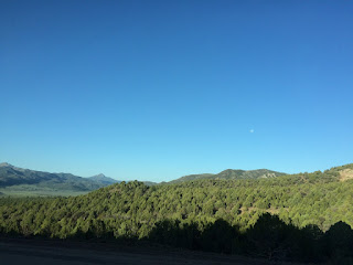
View from Scenic Byway 12 in Utah. Photo by Kristina Blesch.
This is my journey into the wonders and treasures that are contained in these great lands, set aside for all the people past, present, and future that may visit them. With my wife-to-be, it is my intention to visit all 59 National Parks and as many of the other sites in this service as possible. In my writings I hope to share a brief insight into the history and sights of these lands. I will include any tips that I have, of course, but encourage each of you to visit them for yourselves to discover the beauty of this country. The sights contained in the National Parks Service are always changing; seasons, years, and now centuries pass and the natural forces are always playing their part in shaping the parks. I believe that if you give them the chance, the most amazing change that you will see in the lands set aside for us is the change you will see in yourself.


Looking into Bryce Canyon. Photo by Kristina Blesch.

I will be beginning this journey as a 29 year old man, who while healthy, is not in the best shape. It is my hope that as I travel this country I can shed one of the most detrimental world view points of our culture, and demonstrate that we can all create the change in us that we wish for. To start as an “average American” who spends more time on the couch than I should, and improve my lifestyle with hiking, boating and other outdoor skills. I will cut back on the amount of TV that I watch (it is getting repetitive anyway), and instead see what a screen could never show me. The awe inspiring beauty, that is right outside our front doors. Hidden deep in the heart of our land in the National Park System.


Join me, please. Together we can find our parks.